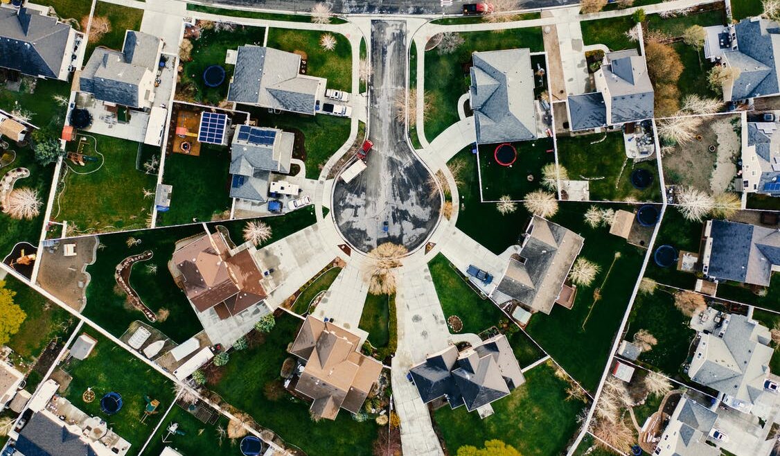


Embark on a transformative mapping journey with our cutting-edge solutions. From intuitive interfaces to real-time updates, we redefine exploration, ensuring our innovative maps captivate users with engaging features, scalability for diverse needs, and versatility that adapts to your unique requirements. Join us in reshaping the future of navigation and discovery
Discover Limitless Possibilities: Our mapping solutions redefine scalability, offering an expansive canvas for your exploration needs. With adaptable features that grow with you, our innovative maps ensure scalability that evolves alongside your ambitions, making every journey a seamless and scalable experience.
Explore the Boundless: Our mapping solutions are more than a map—they're a multifaceted toolkit. Uncover layers of versatility, adaptability, and a myriad of features that cater to your diverse needs. With our innovative approach, we transform every exploration into a multifaceted adventure, ensuring you have the right tools for every mapping challenge.
Our cutting-edge mapping technology pioneers a new era of precision, transforming the way you navigate and visualize the world
Discover a world of possibilities with Map & Allied, your premier partner in mapping services. We specialize in harnessing the true potential of location data to empower businesses, organizations, and individuals. Whether you’re navigating complex landscapes or optimizing your business strategy, we provide cutting-edge mapping solutions tailored to your unique needs.
Welcome to Map & Allied – where the world of possibilities unfolds through our premier mapping services. At Map & Allied, we are dedicated to unlocking the full potential of location data, serving as your trusted partner in navigating through complex landscapes and optimizing business strategies. With a specialization in harnessing the power of location data, we empower businesses, organizations, and individuals alike. Our cutting-edge mapping solutions are tailored to meet your unique needs, ensuring that you have the tools necessary to succeed in today’s dynamic environment. Whether you’re seeking to explore uncharted territories or fine-tune your operational efficiency, Map & Allied is here to guide you every step of the way. Join us as we embark on a journey of discovery, innovation, and endless possibilities. Explore the world with confidence – choose Map & Allied as your premier mapping partner.
Join us on a journey where every pixel tells a story, and every location becomes an opportunity. At M&A, we redefine the possibilities of spatial intelligence. Explore the digital frontier with us, and let our digital mapping solutions be your compass in the ever-evolving landscape of spatial technology. Welcome to a new era of mapping excellence!
Discover the power of Location Analytics with us. From insightful spatial analytics to seamless integration, we specialize in transforming location data into meaningful insights. Whether you're navigating projects, optimizing decisions, or seeking expert guidance, we're here to redefine your spatial journey. Explore the potential where analytics meets innovation and elevate your understanding with us.
Welcome to Map & Allied, your gateway to comprehensive GIS services and solutions. From custom spatial analytics to seamless integration, our expertise empowers businesses to make informed decisions in a dynamic world. Explore the possibilities with us for a transformative spatial journey where GIS meets innovation
- Mapping Platform Development
- Custom Mapping Solutions
- Geospatial Data Analysis
- Location Intelligence Strategy
- GIS Integration and Implementation
- Geospatial Consultancy Services
- Remote Sensing Solutions
- Geospatial Training and Workshops
- Spatial Data Infrastructure (SDI) Services
- Location-based Analytics
Mapping Platform Development
We develop cutting-edge web-based mapping tools that provide intuitive interfaces and powerful functionality for visualizing and analyzing spatial data. Our web-based mapping solutions are accessible from any device with an internet connection, enabling users to explore and interact with maps seamlessly.
Our team designs and develops mobile mapping applications that empower users to access spatial data and perform mapping tasks on the go. Whether it's field data collection, asset tracking, or navigation, our mobile mapping applications provide robust functionality and a user-friendly experience across various mobile devices.
We offer API development and integration services to enable seamless integration of mapping functionality into third-party applications and systems. Our APIs provide developers with access to a wide range of mapping capabilities, allowing them to incorporate mapping functionality into their applications and workflows with ease.
Custom Mapping Solutions
We excel in crafting customized Geographic Information Systems (GIS) applications to meet the unique needs of our clients. Utilizing cutting-edge technologies, we develop GIS solutions that streamline workflows, enhance data management, and unlock valuable insights from spatial data.
Our team specializes in transforming complex spatial datasets into intuitive visualizations that facilitate easy interpretation and communication of geographical information. From thematic mapping to 3D visualization, we create visually compelling representations that empower informed decision-making and strategic planning.
We develop interactive mapping applications that engage users and enable dynamic exploration of spatial data. Seamlessly integrating features such as zooming, panning, and data filtering, our interactive maps enhance user experiences across various platforms, facilitating intuitive exploration and analysis of spatial information.
Geospatial Data Analysis
We excel in interpreting spatial data, providing insights into geographical patterns, trends, and relationships. Our analysis uncovers valuable information for various industries, including urban planning, environmental monitoring, logistics optimization, and market analysis.
Leveraging Geographic Information Systems (GIS), we conduct in-depth analysis of spatial data to address specific client needs. From mapping and spatial querying to spatial statistics and network analysis, our GIS analysis capabilities empower clients with actionable insights and informed decision-making.
Our team specializes in data modeling and simulation techniques to predict spatial phenomena and simulate real-world scenarios. By modeling spatial relationships and simulating potential outcomes, we assist clients in understanding complex spatial dynamics and planning for future scenarios effectively.
Location Intelligence Strategy
We conduct thorough spatial needs assessments to understand the unique requirements of our clients. By analyzing spatial data and identifying key challenges and opportunities, we provide valuable insights that inform decision-making and strategy development.
Our team assists clients in strategic location planning by leveraging spatial data and analysis techniques. Whether it's site selection, facility placement, or expansion planning, we help clients make informed decisions to optimize their location-based strategies and achieve their business objectives.
We provide competitive analysis and benchmarking services to help clients gain a deeper understanding of their market landscape. By analyzing spatial data and comparing performance against industry benchmarks and competitors, we empower clients to identify strengths, weaknesses, and opportunities for differentiation and growth.
GIS Integration and Implementation
Our team provides expert consulting services for integrating GIS technologies into existing systems and workflows. We work closely with clients to assess their requirements, recommend optimal integration solutions, and ensure compatibility and interoperability with other systems.
We optimize GIS workflows to enhance efficiency and productivity. Through process analysis, redesign, and automation, we streamline GIS operations, reduce redundancy, and improve data accuracy and consistency, enabling clients to achieve their goals more effectively.
We offer comprehensive training and support services to empower clients with the knowledge and skills required to effectively utilize GIS technologies. From basic GIS training to advanced skills development, our training programs are tailored to meet the specific needs of users at all levels. Additionally, our dedicated support team provides ongoing assistance and troubleshooting to ensure smooth GIS operations and user satisfaction.
Geospatial Consultancy Services
Our team specializes in developing data acquisition strategies tailored to meet the specific needs of our clients. We analyze data requirements, identify relevant data sources, and recommend optimal acquisition methods to ensure the availability of high-quality spatial data for informed decision-making and analysis.
We offer advanced spatial analysis methodology services to help clients derive meaningful insights from spatial data. Leveraging cutting-edge analytical techniques and tools, we conduct in-depth spatial analysis to uncover patterns, trends, and relationships, enabling clients to make informed decisions and gain a competitive edge.
Our team provides advisory services on GIS best practices to help clients optimize their GIS implementations and workflows. Drawing on our extensive experience and expertise, we offer guidance on data management, system configuration, workflow design, and quality assurance, ensuring that clients maximize the value of their GIS investments and achieve their business objectives.
Remote Sensing Solutions
Our team conducts comprehensive analysis of satellite imagery to extract valuable insights and information. From land cover classification to change detection and environmental monitoring, our satellite imagery analysis services provide clients with actionable intelligence for a wide range of applications.
We specialize in interpreting aerial photography to derive meaningful information about landscapes, infrastructure, and environmental features. Our aerial photography interpretation services help clients gain a deeper understanding of their surroundings, enabling informed decision-making in areas such as urban planning, agriculture, and disaster management.
We offer advanced LiDAR data processing services to extract detailed information about terrain, vegetation, and structures from LiDAR point cloud data. Using state-of-the-art algorithms and techniques, we process LiDAR data to create accurate digital elevation models, 3D terrain models, and other geospatial products that support a variety of applications, including engineering, forestry, and flood risk assessment.
Geospatial Training and Workshops
Our GIS Fundamentals Training provides participants with a solid foundation in geographic information systems (GIS) concepts, tools, and techniques. Through hands-on exercises and practical examples, participants learn essential GIS skills, including data management, spatial analysis, and map production.
We conduct Advanced Spatial Analysis Workshops for professionals looking to deepen their understanding of complex spatial analysis techniques and methodologies. These workshops cover topics such as spatial statistics, geostatistics, spatial modeling, and network analysis, equipping participants with the knowledge and skills to tackle sophisticated geospatial challenges.
We offer customized training programs tailored to the specific needs and requirements of our clients. Whether it's training on specific GIS software platforms, industry-specific applications, or specialized spatial analysis techniques, we work closely with clients to develop training programs that address their unique goals and objectives. Our customized training programs can be delivered onsite or online, depending on client preferences and requirements.
Spatial Data Infrastructure (SDI) Services
Our team assists organizations in planning and designing spatial data infrastructures tailored to their specific needs and objectives. We work closely with clients to assess their spatial data requirements, identify relevant stakeholders, and develop robust SDI frameworks that support efficient data sharing, interoperability, and collaboration.
We help organizations develop data sharing policies and guidelines that promote effective data sharing and collaboration within and across departments, agencies, and organizations. Our team works with clients to define data sharing objectives, establish data access rights and permissions, and implement mechanisms for data discovery, access, and use while ensuring compliance with relevant regulations and standards.
We assist organizations in implementing metadata standards to ensure the consistent and standardized description of spatial data assets within their SDIs. Our team helps clients define metadata schemas, develop metadata templates, and implement metadata management systems to facilitate the discovery, evaluation, and use of spatial data resources. By adhering to metadata standards, organizations can improve data interoperability, discoverability, and usability within their SDIs.
Location-based Analytics
Our team excels in spatial pattern recognition, leveraging advanced analytical techniques to identify and interpret patterns, trends, and anomalies within spatial data. Whether it's identifying clusters of activity, hotspot analysis, or spatial autocorrelation, our spatial pattern recognition capabilities enable clients to uncover valuable insights and make data-driven decisions.
We provide location-based decision support services to assist clients in making informed decisions based on spatial data analysis. By integrating spatial analysis into decision-making processes, we help clients optimize resource allocation, identify optimal locations for facilities or services, and evaluate the potential impacts of their decisions on the surrounding area.
Our team specializes in predictive modeling and forecasting using spatial data. By analyzing historical spatial data and incorporating relevant variables and factors, we develop predictive models that forecast future trends, patterns, and events. Whether it's predicting customer behavior, traffic congestion, or environmental changes, our predictive modeling and forecasting capabilities enable clients to anticipate future outcomes and plan accordingly.
Navigate with Ease: Tailored, User-Friendly, and Interactive Mapping Solutions for your Business
Transform your business with precision digital mapping. Enhance customer engagement, optimize assets, and unlock strategic advantages seamlessly with our tailored solutions.
With our cutting-edge technology and user-friendly interfaces, we’re revolutionizing the way people navigate and understand the world around them.
PRACTICE INDUSTRIES

Visualize data for smarter city development and efficient resource management.

Enhance site selection, valuation, and market analysis with our advanced mapping solutions.

Protect ecosystems and manage resources with our innovative mapping technology.

Optimize infrastructure and service delivery efficiency with our comprehensive mapping solutions.

Streamline logistics, optimize routes, and reduce delivery times with our cutting-edge mapping tools.

Coordinate responses, assess risks & safeguard communities with our mapping solutions.

25+
Join us in navigating diverse landscapes with precision, as our innovative solutions provide extensive coverage and insights across the continent.”
20+
Our dedicated team of seasoned professionals brings unparalleled expertise to every map, ensuring accuracy, innovation, and a customized touch for an exceptional mapping experience
Mapping solutions have evolved far beyond simple navigation aids; they now serve as indispensable tools for businesses across various sectors. From optimizing supply chain logistics to enhancing customer experience, these solutions offer multifaceted benefits that directly impact the bottom line. This introduction delves into the transformative potential of mapping solutions, illustrating how they empower businesses to navigate complex challenges and seize opportunities in an increasingly interconnected world.
Join us on a journey as we explore the myriad ways in which mapping solutions unlock strategic advantages, drive operational efficiency, and foster innovation across diverse business landscapes. Whether you’re a seasoned industry leader or a burgeoning startup, the insights presented here will illuminate the path to leveraging location intelligence for sustainable growth and success.
Transform your business with precision digital mapping. Enhance customer engagement, optimize assets, and unlock strategic advantages seamlessly with our tailored solutions to cater to your specific industry needs.
Simplify complex data with our visual mapping tools. Transform information into clear visualizations, enabling you to identify patterns, make informed decisions, and seize opportunities.
Harness the power of leading map APIs, including Google, HERE, and TomTom, seamlessly integrated by our company. Elevate your applications with precision, reliability, and global coverage for an unparalleled mapping experience.
Elevate customer experiences with our location-based services. Integrate mapping features into your applications for personalized recommendations, proximity alerts, and impactful location-based marketing.
Gain a competitive advantage with our location-based market analysis. Unlock insights into customer demographics, preferences, and trends, guiding strategic decisions for targeted growth.
Harness the power of spatial intelligence to inform your decisions. Our mapping and GIS services provide the analytical tools needed to assess risks, identify growth opportunities, and support strategic decision-making.
Real-Time Solutions for Efficient Asset Management. Optimize asset utilization with real-time tracking and management solutions. Monitor vehicles, equipment, and inventory efficiently, reducing the risk of loss and enhancing operational control.
Streamline your supply chain with our advanced mapping solutions, offering efficient route planning, real-time tracking, and logistics optimization